28 July 2021
Request:
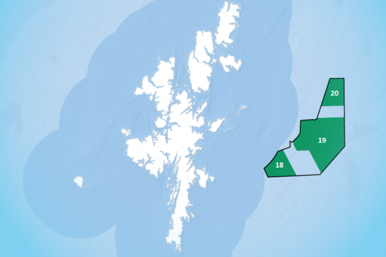
Please can you provide copies of any records that would show the ownership of the foreshore and sea shown with the broken red lines on the plan annexed?
Response:
The attached plan highlights between the red-pecked lines A to B Foreshore (between mean high-water springs and mean low water springs) is non-Crown Seabed (below mean low water springs) remains Crown land.